Reverse Geocoding of Japanese Administrative Divisions

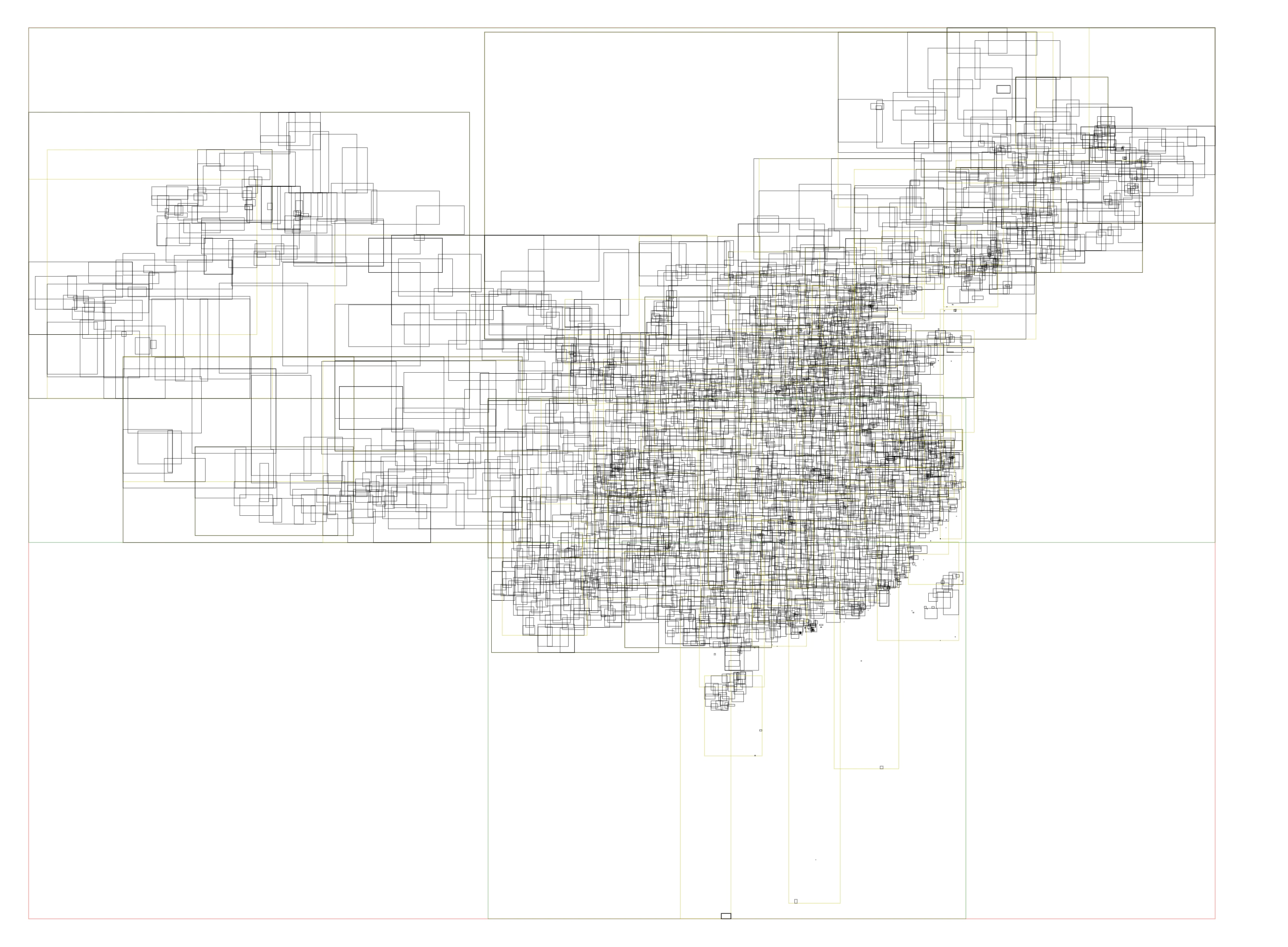
A few months ago, I wanted to map Japanese coordinate data to administrative division levels. To achieve this, I developed a reverse geocoding tool reversejp using administrative boundary data from the Japan Meteorological Agency (JMA). The core functionality is implemented in Rust, and I packaged it as a Python library using PyO3 and Maturin. Although Japan’s land area is not very large, the JMA dataset subdivides the country into over 3,000 administrative units at its finest level. Considering Japan’s total land area, this results in extremely fine-grained coverage. ...

 · 2 min · 231 words · ringsaturn

How to look up GPS location belongs to which administration?

This is English version of 《彩云天气地理查询优化(2): 行政区划查询》. With some minor changes. In ColorfulClouds App and ColorfulClouds Weather API, we could get current GPS location’s weather alert information, such as “Gale Blue Alert”. Different countries and regions have different rules for issuing alerts. In China, it is issued according to the administrative division level, and the smallest is the county-level administrative division. Therefore, in the implementation, it is necessary to convert the GPS location into the administrative division level information, and then find the relevant alert information. ...

 · 3 min · 1310 words · ringsaturn