Nömrög Grassland Fire in Dornod, Mongolia: Satellite Monitoring and Weather
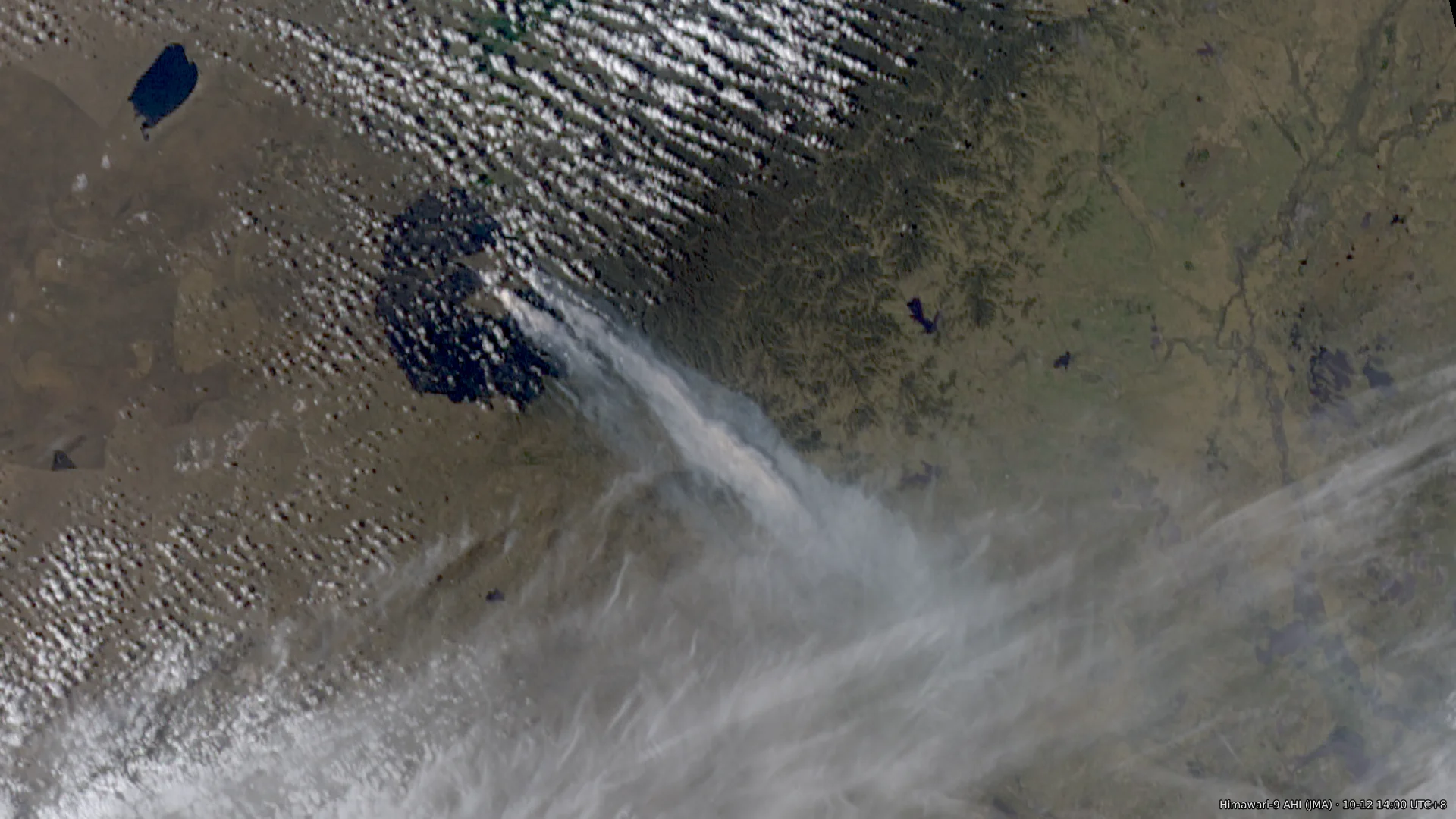
Note This post was written with the help of an LLM. Unless stated otherwise, times are China Standard Time (UTC+8). Around noon on 2026-10-08, a fire started near Nömrög (Нөмрөг) in Khalkhgol soum, Dornod Province, Mongolia, about 27 km from the China–Mongolia border. Two geostationary satellites put the ignition between 11:41 and 11:51, and Mongolia’s National Emergency Management Agency (NEMA) received the call at 11:551. The Mongolian telecom operator Mobicom is a subsidiary2 of Japan’s KDDI. Its statement of 10-123 says that a vehicle caught fire while a group was handing over telecommunications work at border outposts and the Sümber border crossing and surveying local conditions, and that this started the grassland fire. The statement4 of Mongolia’s General Authority for Border Protection says the vehicle caught fire “due to the carelessness of citizens who entered the border zone”. The Dornod Province police department began investigating5 the cause of the fire on 10-17; as of 10-19 no findings have been published. The fire peaked twice, on the evening of 10-10 and during the day on 10-11, and on 10-11 and 10-12 its front reached the border west of Arxan City, Hinggan League, Inner Mongolia. After a cold front passed early on 10-12 the fire weakened. Residual burning continued intermittently inside the Mongolian fire area until the afternoon of 10-15, after which the satellites detected no more fire pixels; NEMA declared the fire fully extinguished at 07:00 on 10-166. The burned area is about 4,900 km². Montsame, quoting the Mongolian emergency services, reports that about 80% of the Nömrög Strictly Protected Area burned7. China deployed first more than 2,0008 and then more than 3,4009 personnel along the border, and its reports say the fire did not cross the border line. The satellites show no contiguous burned area extending into China, and two burned patches on the Chinese side: about 12 km² in the south section, on the East Ujimqin Banner side, consistent with the backburning operations that the East Ujimqin Banner authorities reported publicly; and about 0.9 km² west of Arxan, which is inferred to be fire that crossed the border by about 1 km and was then stopped by the firebreak that Hinggan League created by counter-burning (对冲点烧, backburning toward the oncoming fire) along the border from 10-11. Smoke reached Hailar on 10-11 and Baicheng on 10-12, and the PM2.5 peaks in the two cities on those days contain smoke from this fire. This post records the accounts from the parties involved, the ignition time and the spread, the weather at the fire area, the burned area, the assessment of burning near the border, and the smoke transport. The confidence in each conclusion is listed at the end. ...