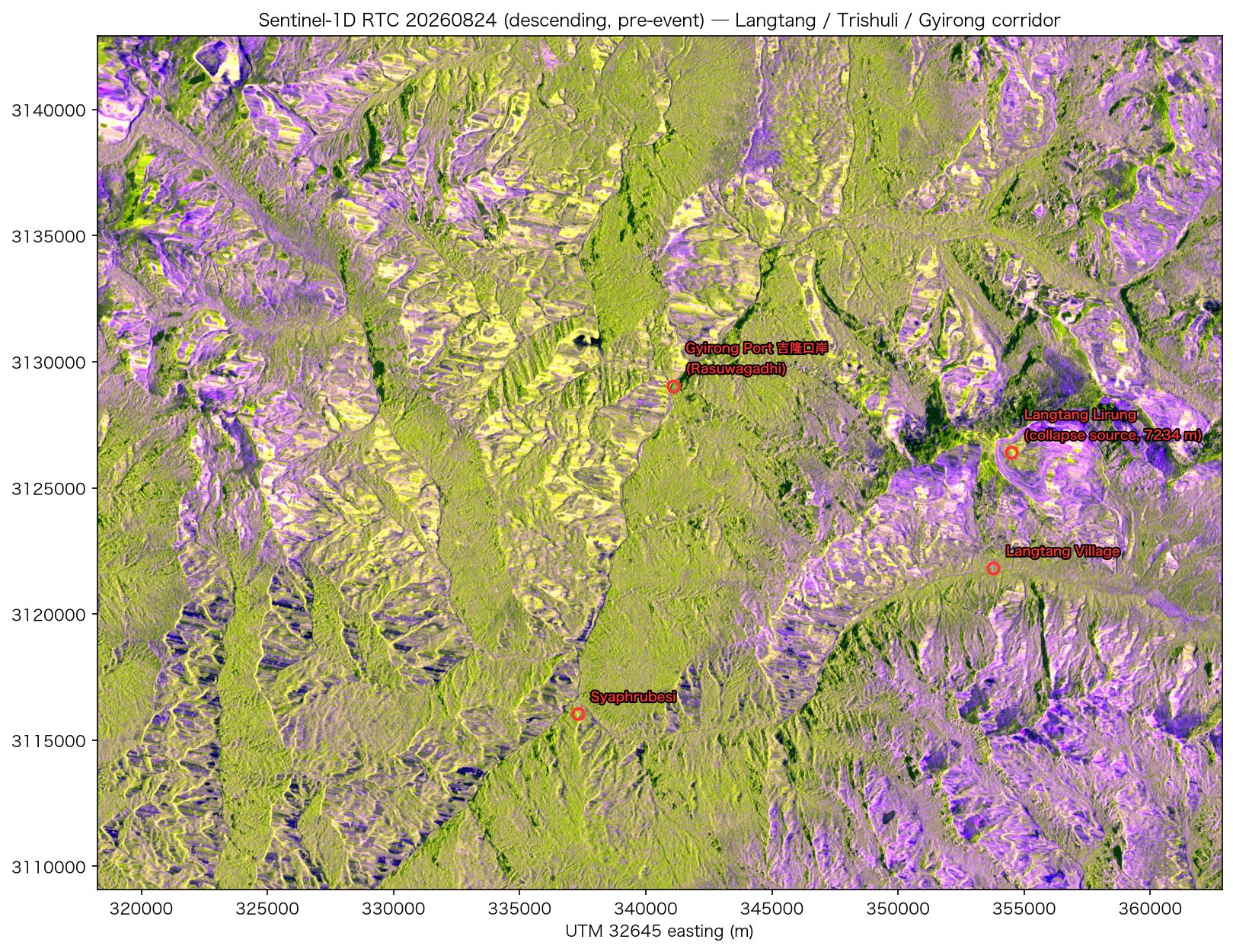
Note The satellite data in this post (Sentinel-1, NISAR and the optical scenes) was retrieved, processed and composited by the author. Claude compiled the text from those processed results and from public news reporting. Processing parameters and acquisition times are taken from the data itself; the event description and casualty figures come from the public sources linked in the text.
At 02:52:10 UTC on 2026-08-26 (08:37 Nepal time, 10:52 China time), an ice and rock cliff on the north side of Langtang Lirung collapsed inside Langtang National Park. USGS located the source from seismic waves, on the north face of a peak roughly 7,200 m high; the main event released energy equivalent to M5.2, followed about 3 hours later by a secondary collapse equivalent to M4.2. AntarcticGlaciers gives the detachment coordinates as 28.2853°N, 85.5252°E and states that the present evidence does not support a glacial lake outburst flood (GLOF); the proposed mechanism is a multi-hazard cascade of ice and bedrock failure, rock/ice avalanche and debris flow, temporary river blockage, then outburst flooding. The author describes all of these as preliminary.
The debris flow travelled about 100 km down the Bhote Koshi and Trishuli rivers and destroyed the customs facilities at the Rasuwagadhi border crossing along with the China–Nepal highway. The Wikipedia article records, as of 28 August, 547 dead and 977 missing on the Nepali side and 5 dead and 558 missing on the Chinese side; the search is ongoing, sources differ in what they count and when they were updated, and the figures are still changing. The same area saw a large ice and rock avalanche during the 2015 Gorkha earthquake that buried villages in the Langtang valley and killed more than 350 people.
This post records the data work done in the two weeks after the event: building the Sentinel-1 pre-event baseline, processing the first obtainable post-event SAR data (NISAR, L-band) and the first post-event Sentinel-1 scene, and then the four viewing geometries that followed.
...